


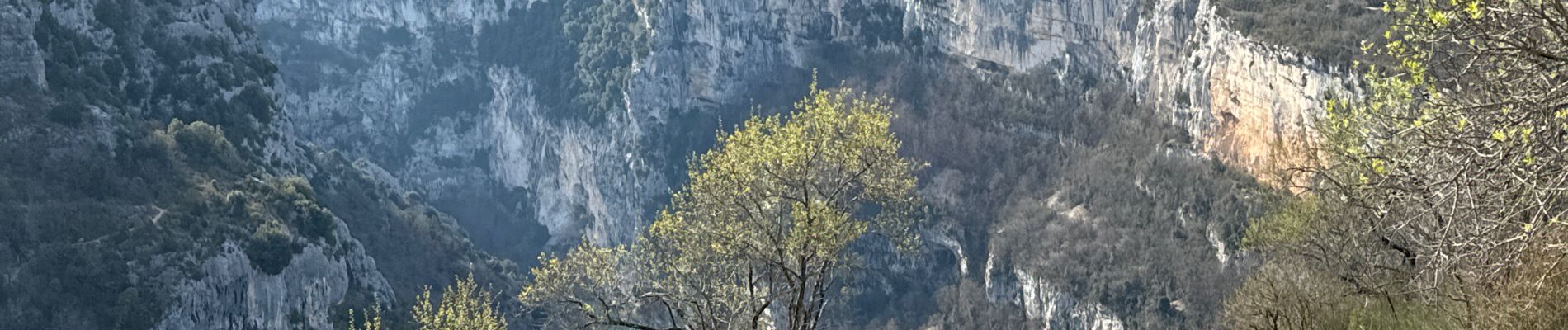
Sentier Blanc Martel

ETMU5496
User
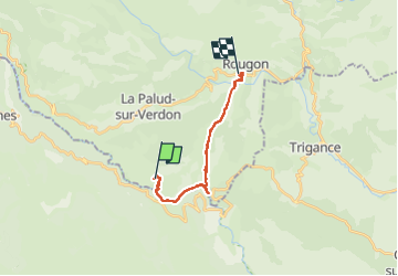

Length
15.6 km

Max alt
902 m

Uphill gradient
1100 m
Km-Effort
31 km

Min alt
561 m

Downhill gradient
1201 m
Boucle
No
Creation date :
2024-03-20 08:23:51.0
Updated on :
2024-03-22 15:37:33.222
6h57
Difficulty : Difficult

FREE GPS app for hiking
 SityTrail
IGN / Geographical institutes
SityTrail Plus
The world is yours!
About
Trail Walking of 15.6 km to be discovered at Provence-Alpes-Côte d'Azur, Alpes-de-Haute-Provence, La Palud-sur-Verdon. This trail is proposed by ETMU5496.
Description
IBP=75
Photos


58 photos in total. Please click on a photo to see them all in the gallery.
Positioning
Country:
France
Region :
Provence-Alpes-Côte d'Azur
Department/Province :
Alpes-de-Haute-Provence
Municipality :
La Palud-sur-Verdon
Location:
Unknown
Start:(Dec)
Start:(UTM)
286296 ; 4847195 (32T) N.
Comments